Nine coal miners spent three days in an air pocket underground.

 |  | Susan Price & Marcus Grant October 10, 2026 |
THE SHORT VERSION |
• A Pennsylvania coal crew cut into an old flooded mine. • The map they worked from was never certified. • Nine men spent three days in an air pocket. • The water stopped four feet below their floor. |
THE SETUP |
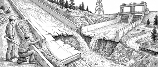
Quecreek #1 was a small bituminous mine in Somerset County, Pennsylvania, working the Upper Kittanning seam from four drift openings cut in 2001. Black Wolf Coal Company ran it with 61 people, 55 of them underground, and reported 161,577 tons for the first half of 2002. Immediately up dip, across the permit boundary, sat a mine that had been full of water for decades. It opened in 1913, passed to Saxman Coal and Coke in 1925, stood idle from 1934 to 1941, and worked until 1963. By the end it was called Harrison No. 2. Mining into one of these is, as the research agency puts it, uncommon but very preventable. Pennsylvania law has long required a final map when a mine is abandoned, and in April 2002 the state issued guidance letting operators file that map as a digital image, certified by letter and seal. The permit map showed the old workings well clear. A regular inspection had finished six weeks earlier. |
THE TIMELINE |
Every row below comes from one document: the Mine Safety and Health Administration Report of Investigation into the nonfatal entrapment of 24 July 2002, released on 12 August 2003 after twelve months and nine investigators. It records the whole event in surveyed elevations, in feet above sea level, and so does the table. Read the last two rows together. The water climbed for more than a day and then held at 1835.2 feet, and the floor the nine men were standing on was 1839.5 feet. Nothing done underground set that level. The lowest of the four portals, in a pit some 4,500 feet out along the Mains, sat at 1836.3 feet, and the water found the top of that pit and went no higher. |
THE BREAK |
Four things stood behind this, and the water was the last of them. • The permit map was undated and uncertified. The map of Harrison No. 2 used to draw the old workings onto the Quecreek plan did not show the complete and final extent of them. MSHA named this the primary cause. • The certified map did not exist where it was meant to. The root cause, in the report's own words, was the unavailability of a certified final mine map for Harrison No. 2 in the Pennsylvania mine map repository. A mine that stopped work in 1963 had never filed one. • A better map existed, in the wrong building. A 1964 map of the same workings was held by the Windber Coal Heritage Center. Investigators examined it afterwards. It had never reached the state repository. • The rock gave nothing away. Wet bolt holes and bad roof came from an aquifer and a clay-filled fault, and the crew had mined through the same conditions a thousand feet earlier. There was no seepage at the face even within a few feet of the old pool. |

WHO PAID |
Nobody was hurt. Eighteen men were underground. Seven from the 2-Left section and two outby walked out through the intake entry. Nine built five block walls, moved to the highest floor on the section, and came up one at a time in the agency rescue capsule between 12:55 and 2:45 a.m. on 28 July. The operator drilled again. Two horizontal holes were put in seam, 2,100 feet north and 2,000 feet south, and neither one met any old workings. Five months on, water was still running out of the 6.5-inch hole. The archive is the part that outlives the story. The National Mine Map Repository, set up by an act of Congress in 1969, holds data on more than 275,000 closed and abandoned mines, all of it donated. It says in writing that it cannot vouch for their accuracy. |
THE PATTERN |
• A line on a drawing is not a wall. The boundary on the permit map was a line traced from an older sheet. The coal it stood for ran out before the face did. • Ask who signed it, and when. The 2002 guidance asks for a letter and a seal. The sheet that mattered came from a mine that stopped work in 1963 and was never signed. • Quiet is not the same as clear. There was no seepage at the face even a few feet from the old pool. The absence of a sign meant nothing at all. • Some things can be checked in the room. Gold is the other case. One bar carries one weight and one assay, and a man with a scale can confirm both without sending anywhere for a document. I worked a desk in 1994 where the position limit everyone traded to came off a sheet nobody had rechecked since the firm changed clearers. Put one question to any holding: which line on which document is the boundary, and who signed it, and when. |